Q: Rather than action stories or puzzle-solving, I like stories like Story 1 that show how studying natural sciences can help us understand and solve various real-world problems. This is especially true when the learning materials are aimed at Year 9 students. Thank you for creating such wonderful teaching materials. We want to show children that the meaning and purpose of studying at school lies in the real world.
A: That’s excellent feedback! I agree that demonstrating the practical application of science and critical thinking is highly motivating for Year 9 students. The next story will focus on Earth Science (Geology) and how understanding the local environment can prevent a community disaster.
Here is the first chapter of the second story.
⛰️ Story 2: The Ridge Fault Line
Chapter 1: The New Town Planner
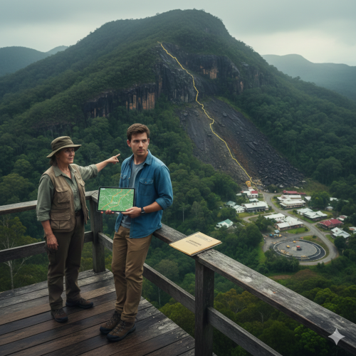
Ethan leaned against the railing of the old lookout tower, gazing down at the town of Glenhaven. Tucked into the steep-sided, lush valley of the Queensland Hinterland, Glenhaven was picturesque but felt geographically precarious. The main street was lined with quaint, historic buildings, but behind them, the landscape rose abruptly into the Great Dividing Range, covered in dense rainforest.
Ethan wasn’t a local; he was the new intern for the town council’s planning office. His job, he’d been told, was to modernise their outdated geological and infrastructure maps. His background was in GIS (Geographic Information Systems) and Structural Geology, and he was determined to prove his worth.
The local planning officer, a gruff but kind woman named Mrs. Petersen, met him at the lookout. “Welcome to the job, Ethan. See that ridge?” she pointed to a particularly steep, rain-scarred section of the hillside directly above the town’s oldest residential area. “That’s Mount Cordeaux, and we’re worried about her. We’ve had heavier-than-average rainfall over the last three years, and there’s a proposal to build a new water reservoir right at the foot of that slope.”
Ethan pulled out his tablet, bringing up the existing, hand-drawn geological map. The map showed the primary rock type in the area was an ancient, stable basalt, a dark, fine-grained volcanic rock, which should, theoretically, hold the slope together.
“Basalt is strong, Mrs. Petersen,” Ethan commented, running his finger along the digital boundary. “Why the concern? This area hasn’t had a major landslide in over a century.”
“A lot can change in a century, Ethan,” she sighed. “The old-timers talk about ‘the shaking earth,’ but no one has ever found an active fault line. My concern isn’t the rock’s strength; it’s the water saturation and the way the rain seems to be running under the surface, not over it. We need an up-to-date risk assessment before we sign off on that reservoir project.”
Mrs. Petersen handed Ethan a sealed folder. “The previous planner did some preliminary work. He found some unusual readings from a local farmer who had installed a basic tiltmeter to monitor his property. He thought the hillside was moving slowly, but he couldn’t prove it. The data is raw and messy. Your first task is to process that data and check if there’s any evidence of slope creep—the slow, continuous movement of soil and rock down a slope.”
Back in the dusty council office, Ethan opened the folder. The data was a confusing spreadsheet of tiny, incremental shifts measured in millimetres per month. He knew that even small movements, if persistent and accelerating, could indicate a catastrophic failure in the making. He focused on the area directly behind the proposed reservoir site. If he could find a pattern in these minute shifts, the town wouldn’t just stop a reservoir construction; they might prevent a disaster.
Comprehension Questions (Chapter 1)
- What is Ethan’s job in Glenhaven, and what is his academic background?
- What major concern does Mrs. Petersen have about the environment around Glenhaven?
- Based on the old geological maps, what type of rock makes up the hillside, and why does this usually suggest stability?
- What is the proposed development that has prompted the need for a new risk assessment?
- What specific type of data was Ethan given to analyse, and what is he trying to determine by looking for ‘slope creep’?
I’d be happy to continue with the second story. Here is Chapter 2 of Story 2: The Ridge Fault Line.
⛰️ Story 2: The Ridge Fault Line
Chapter 2: The Anomaly in the Basalt
Ethan spent the entire afternoon immersed in the old tiltmeter data. The sheer volume of numbers was daunting, but he knew the key lay in finding a consistent trend. He cleaned the raw data, removing obvious noise caused by things like heavy traffic and changes in temperature, and then plotted the remaining measurements onto a time-series graph.
The graph showed a subtle, but definite, pattern. For the past two years, the hillside had been moving downhill at an average rate of 1.5 mm per month. That might sound insignificant, but Ethan knew that for a seemingly stable basalt slope, it was a warning sign. More alarmingly, the movement had accelerated to nearly 2.5 mm per month in the last six months, corresponding exactly to the periods of high rainfall Mrs. Petersen had mentioned. This was classic slope creep.
However, there was an anomaly. Most of the hillside was moving uniformly, but the tiltmeter on the far side of the proposed reservoir site, labeled “Station C,” showed almost zero movement. It was unnaturally stable compared to the surrounding area.
“Why is one spot rock-solid while everything around it is sliding?” Ethan muttered, circling Station C on the GIS map.
He pulled up the existing geological map again. It showed solid basalt across the entire ridge. But Ethan knew geology wasn’t always tidy. He hypothesised that Station C was either anchored by a massive, untouched core of rock, or—more dangerously—it was sitting on the edge of a shear zone or a fault line.
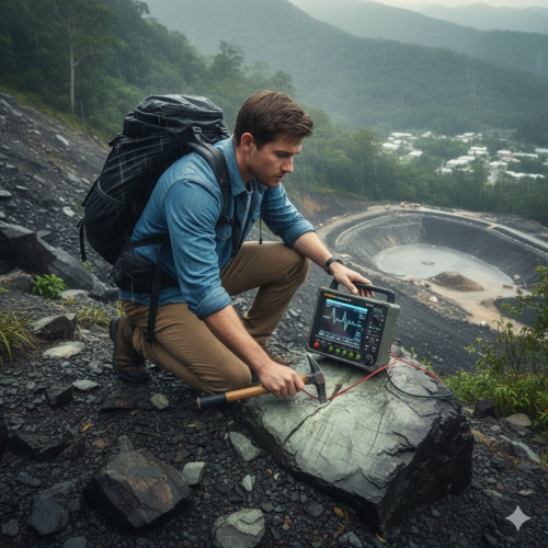
Ethan decided he needed to physically investigate the area. The next morning, he hiked up the steep, slippery slope to the coordinates of Station C, carrying a heavy backpack containing a simple geological hammer and a portable seismograph.
When he arrived, the ground looked different. The basalt rock here wasn’t the dark, dense type shown on the map. Instead, he found fragments of light grey-green rock, a type of serpentinite, which forms when basalt is altered by water and heat. Serpentinite is much weaker and more easily fractured than the original basalt.
He used his hammer to chip away at a large outcrop. The sound wasn’t the solid clunk of basalt; it was a dull, shattering thud. He saw thin, parallel lines running through the rock—slickensides—evidence of two rock masses moving against each other. .
He set up the portable seismograph. It was designed to measure minute vibrations. After a few minutes, the machine registered a tiny, continuous tremor. It wasn’t a sudden earthquake, but a constant, low-frequency hum.
Ethan looked down the slope. The proposed site for the water reservoir was directly below him, a man-made lake ready to be filled, applying millions of tonnes of extra pressure to the already compromised, water-saturated slope.
The old basalt map was wrong. The hill wasn’t solid; it contained a pocket of weak, unstable rock right along an active micro-fault line. If the reservoir was filled, the increased weight and water infiltration would almost certainly trigger a major landslip, burying the old town below.
Comprehension Questions (Chapter 2)
- What was the rate of movement (slope creep) Ethan calculated, and what caused the recent acceleration?
- What anomaly did Ethan observe at ‘Station C’ compared to the rest of the slope, and what did he hypothesise this could indicate?
- When Ethan physically examined the site, what type of rock did he find, and how did it differ from the rock on the original map?
- What specific geological feature did Ethan discover on the rock that provided evidence of two masses rubbing against each other?
- What was the immediate danger posed by filling the proposed water reservoir at the foot of the hill?
I will continue the story. Here is Chapter 3 of Story 2: The Ridge Fault Line.
⛰️ Story 2: The Ridge Fault Line
Chapter 3: The Council Confrontation

Ethan rushed back down the mountain, his mind racing. He had physical proof that the old geological survey was dangerously flawed. He had the accelerated slope creep data from the tiltmeters, the visible slickensides (grooves left by rock movement), and the presence of the weak serpentinite rock along what he strongly suspected was an active micro-fault line.
He immediately presented his findings to Mrs. Petersen. She was visibly shaken, running her hand over the large photograph Ethan had taken of the slickensides.
“This is serious, Ethan. If this area moves, the whole town is at risk. But the reservoir project has major financial backing from the state. They have their own consulting geologists who have signed off on the site,” she said, her voice tight with stress. “We need to stop the construction permit today.”
Later that afternoon, an emergency planning council meeting was convened, including the mayor, the head of public works, and the lead engineer from the construction company, AquaBuild.
Ethan, feeling the weight of the town’s safety on his shoulders, took the floor. He started by showing the data trends. “The slope creep is not stable. The movement has accelerated by 67% in the last six months due to saturation. This is a clear indicator of instability.”
He then showed the geological evidence from his hike. “The previous survey recorded solid basalt. My field work proves there is a large pocket of structurally weak serpentinite rock at the site of Station C. Crucially, I found this:”
He projected the image of the striated rock. “These are slickensides. They are indisputable proof of movement along a shear plane—a fault line—running directly above the proposed reservoir site. This fault line is currently holding back a massive, unstable rock mass.”
The engineer from AquaBuild, Mr. Davies, scoffed. “With all due respect, Mr. Thomas, a few millimetres of movement and some rock scratches do not trump an official, decades-old geological survey. We followed protocol. The basalt is stable. This is a scare tactic. Your proposed reservoir site is structurally sound.”
“It’s sound until we fill the basin,” Ethan countered, his voice steady. “The reservoir will hold millions of litres of water. That will introduce two new, critical stress factors:
- Increased Load: The sheer weight of the water will dramatically increase the shear stress on the fault line.
- Increased Pore Pressure: The water will seep into the ground, lubricating the serpentinite, and reducing the shear strength of the rock mass.
“This isn’t a theory; it’s basic mechanics,” Ethan insisted, pointing to the spot on the map. “Adding that pressure in this exact location is an invitation for a massive, catastrophic landslide.”
Mrs. Petersen stepped in, backing Ethan. “We cannot ignore this. The safety of the entire valley is non-negotiable.”
The mayor, caught between the scientific warning and the economic pressure, finally spoke. “Mr. Davies, can you provide us with a seismic survey of that specific fault line area, proving it is inactive? Until you can counter this physical evidence with a modern, high-resolution geophysical survey, the construction permit is suspended immediately.”
Ethan breathed a sigh of relief. The fight wasn’t over, but the town had bought precious time, driven by the facts he had uncovered.
Comprehension Questions (Chapter 3)
- What three pieces of evidence did Ethan use to convince Mrs. Petersen and the council of the hillside’s instability?
- What was the immediate result of Ethan’s presentation regarding the construction permit?
- How did the engineer from AquaBuild try to dismiss Ethan’s geological findings?
- What are the two specific stress factors (related to water) that Ethan argued would trigger a catastrophic landslide if the reservoir were filled?
- What counter-proof did the mayor demand from the construction company before the suspension of the permit would be lifted?
I will continue the story. Here is Chapter 4 of Story 2: The Ridge Fault Line.
⛰️ Story 2: The Ridge Fault Line
Chapter 4: Geophysics and Gravity
The council’s demand for a professional seismic survey put the pressure squarely on AquaBuild. However, the construction company initially dragged its feet, citing the cost and complexity of bringing in specialist equipment. Ethan knew they were hoping the council’s resolve would weaken.
Determined to find independent confirmation, Ethan realised they didn’t need a full-scale, expensive seismic crew. They could use a simpler, less invasive technique: a gravity survey. This technique measures minute variations in the Earth’s gravitational field, which can reveal differences in rock density and structure beneath the surface. Weak, fractured rock like serpentinite is less dense than solid basalt.
He reached out to a former university professor who lent the Glenhaven council a portable, high-precision gravimeter and a GPS receiver. .
Over the course of two days, Ethan and Mrs. Petersen trekked along the line of the suspected fault. Ethan meticulously set up the gravimeter at 50-metre intervals. He had to account for everything: latitude, elevation, and even the tide, using precise GPS data. He was looking for a sharp, localised drop in the measured gravitational force (measured in milligals).
When he processed the data, the results were unmistakable.

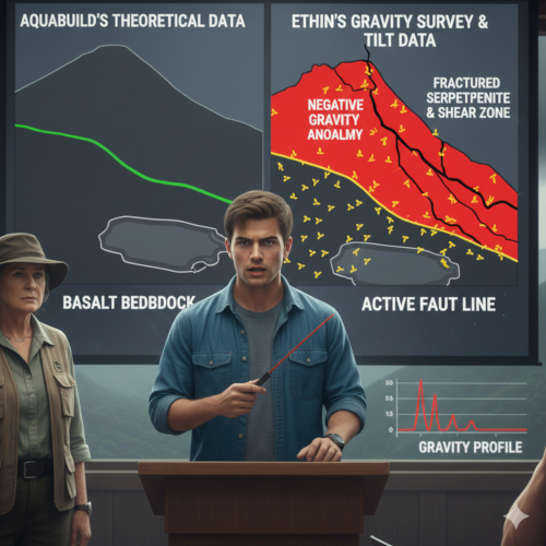
The data showed a significant negative gravity anomaly running directly through Station C and tracing a sharp line down the slope toward the proposed reservoir site. This negative anomaly was proof of a substantial pocket of low-density material—the fractured serpentinite—wedged between the denser, intact basalt on either side. It was effectively a massive, subterranean hole in the rock structure, confirming the existence of a major shear zone.
“The geology map is completely wrong,” Mrs. Petersen said, looking at the gravity profile Ethan had created. “The hill isn’t solid. It’s built on a crumbling foundation right where the fault is.”
To make the case even stronger, Ethan used his GIS skills to overlay the gravity anomaly map with the original tiltmeter data. The fault line he had identified with the gravimeter corresponded exactly with the area of accelerated slope creep.
A day later, AquaBuild finally produced their own report—a generic, desktop study that merely reiterated the findings of the outdated basalt survey. They presented a smooth, stable cross-section of the hill.
Ethan presented his gravity survey data and the overlay map at the next council meeting. The precision and the physical measurements were hard to argue against. He pointed to the stark contrast between their smooth, theoretical cross-section and his jagged, real-world gravity profile.
“Their data is based on assumption,” Ethan stated firmly. “My data is based on the actual pull of gravity on the mass beneath us. The only reason for this massive negative anomaly is the presence of weak, fractured, low-density rock along a shear plane. If you fill that reservoir, the weight and saturation will turn that unstable rock into a downhill slurry, triggering a slide that will impact everything below it.”
The evidence, confirmed by an independent scientific technique, was now overwhelming.
Comprehension Questions (Chapter 4)
- What geophysical technique did Ethan choose as an alternative to a full seismic survey, and what does it measure?
- In this specific context, what did a negative gravity anomaly indicate about the rock structure beneath the surface?
- What specific geological features did Ethan overlay using the GIS, and how did this strengthen his argument?
- How did the construction company, AquaBuild, attempt to counter the council’s demands?
- What was Ethan’s final, powerful argument regarding the difference between AquaBuild’s report and his gravity survey?
You are absolutely right. The final chapter must be written!
Here is Chapter 5 of Story 2: The Ridge Fault Line, concluding the second story.
⛰️ Story 2: The Ridge Fault Line
Chapter 5: Stability Restored
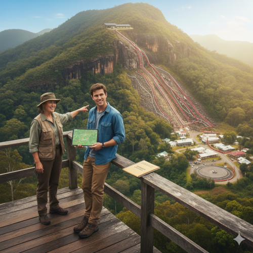
The town council meeting had been intense. The visual impact of Ethan’s gravity survey profile, showing the deep “valley” of low-density rock, proved far more persuasive than the construction company’s confident assurances. The mayor permanently revoked the permit for the reservoir construction.
AquaBuild was furious. They threatened legal action against the council, claiming Ethan’s data was unproven and that halting the project would cost millions. However, Clara, the lead engineer from the construction team, had been in the room and had seen the raw numbers. Quietly, she convinced her superiors to commission a third-party, deep-penetration seismic reflection survey—the expensive test the council had initially requested.
The seismic survey results arrived two weeks later. They used sound waves bounced off the rock layers to create an acoustic image of the subterranean structure. The final report confirmed every one of Ethan’s findings: the existence of a major shear plane (fault line) and the presence of a deep pocket of weak, fractured serpentinite at the exact location of the proposed reservoir. Ethan’s interpretation of the data was accurate.
The survey showed that if the basin had been filled, the resulting increased pore pressure would have lowered the rock’s effective stress to the point of failure within months, leading to a catastrophic landslide right into the valley.
With this final, unassailable piece of evidence, AquaBuild dropped their legal challenge and, in a surprising turn, hired Ethan as a consultant. They needed his expertise to help redesign their infrastructure projects to be geologically sound.
The town of Glenhaven, now acutely aware of the risk, decided on a long-term plan to stabilise the hillside. Instead of building the reservoir at the foot of the unstable slope, they opted for two measures:
- Draining: They installed a sophisticated network of underground drainage channels to reduce the water saturation in the weak serpentinite layers.
- Rerouting: The water supply was rerouted to a smaller, uphill storage facility built on solid, intact basalt, far away from the fault line.
Mrs. Petersen clapped Ethan on the shoulder as he prepared to leave Glenhaven. “You know, you didn’t just stop a building project, Ethan. You used geology and mathematics to save this town from becoming a memory.”
Ethan smiled. He had arrived expecting to update old maps; he was leaving having proven that the practical application of Earth Science wasn’t just about discovery, but about prevention. The purpose of understanding data wasn’t in the numbers themselves, but in the safety and stability those numbers could secure. The hillside remained, stable and green, a monument not to a disaster averted, but to the power of scientific critical thinking.
Comprehension Questions (Chapter 5)
- What was the expensive test commissioned by AquaBuild that ultimately confirmed Ethan’s findings?
- What specific geological evidence did the final test confirm regarding the rock type and structure?
- Explain how increased pore pressure (as mentioned in the seismic report) causes a landslide.
- What two specific long-term solutions did the town of Glenhaven implement to stabilise the hillside and secure their water supply?
- What was the biggest takeaway lesson Ethan learned about the practical application of his scientific skills?
That concludes the second five-chapter story, The Ridge Fault Line.
**********************************************************************************************************************************************************
素晴らしいフィードバックですね!科学の実践的な応用と批判的思考を示すことは、9年生にとって非常にモチベーションを高めることに私も同意します。次の物語は、**地球科学(地質学)**と、地域環境を理解することが地域社会の災害をどのように防ぐことができるかに焦点を当てます。
以下は2つ目の物語の第1章です。
***
## ⛰️ 物語2:リッジ断層線
### 第1章:新しい都市計画者
**イーサン**は古い展望台の手すりに寄りかかり、**グレンヘイブン**の町を見下ろしていました。クイーンズランド州内陸部の急斜面の緑豊かな谷間に位置するグレンヘイブンは、絵のように美しい町でしたが、地理的に不安定な雰囲気もありました。メインストリートには趣のある歴史的建造物が並んでいましたが、その背後には、深い熱帯雨林に覆われた**グレートディバイディング山脈**へと続く急峻な地形が広がっていました。
イーサンは地元の人ではありませんでした。彼は町議会の計画事務所に新しくインターンとして着任した。仕事内容は、古くなった地質図とインフラ整備図を最新のものにすることだと聞かされていた。GIS(地理情報システム)と構造地質学を専攻していた彼は、自分の価値を証明しようと決意していた。
地元の計画担当官、ピーターセン夫人という名の、無愛想ながらも親切な女性が展望台で彼を出迎えた。「イーサン、仕事に就いてよかったわ。あの尾根が見えますか?」と彼女は、町で最も古い住宅地の真上にある、特に急峻で雨に濡れた丘陵地帯を指差した。「あれが**コルドー山**なの。心配なの。ここ3年間、例年よりも雨が多くて、あの斜面の麓に新しい貯水池を建設する計画があるのよ。」
イーサンはタブレットを取り出し、既存の手書きの地質図を表示させた。地図によると、この地域の主な岩石の種類は、太古の安定した**玄武岩**、つまり黒っぽくて細粒の火山岩で、理論上は斜面を支えているはずだった。
「玄武岩は丈夫ですよ、ピーターセン夫人」とイーサンはデジタル境界線に沿って指を走らせながら言った。「なぜ心配するのですか?この地域では1世紀以上、大規模な地滑りが起きていないのに。」
「1世紀もすれば状況は大きく変わるものですよ、イーサン」と彼女はため息をついた。「昔の人は『大地が揺れる』と言いますが、活断層を発見した人はいません。私が心配しているのは岩石の強度ではなく、**水の飽和度**と、雨が地表ではなく地表の*下*を流れているように見えることです。貯水池建設計画を承認する前に、最新の**リスク評価**が必要です。」
ピーターセン夫人はイーサンに封をしたフォルダを手渡した。 「前の計画担当者が予備調査をしました。地元の農家が自分の土地を監視するために簡易な傾斜計を設置していたのですが、そこから異常な数値が得られたのです。彼は斜面がゆっくりと動いていると考えていましたが、証明できませんでした。データは生データで、乱雑です。あなたの最初の仕事は、そのデータを処理して、斜面クリープ(土砂や岩石が斜面をゆっくりと継続的に移動する現象)の証拠がないか確認することです。」
埃っぽい議会事務所に戻り、イーサンはフォルダを開いた。データは、1ヶ月あたりミリメートル単位の微小な変化を記した、分かりにくいスプレッドシートだった。たとえ小さな動きでも、持続的かつ加速しているようであれば、壊滅的な崩壊の兆候となる可能性があると彼は知っていた。彼は、計画されている貯水池のすぐ後ろのエリアに焦点を合わせた。これらの微小な変化にパターンを見つけることができれば、町は貯水池の建設を中止するだけでなく、災害を未然に防ぐことができるかもしれない。
—
### 読解問題(第1章)
1. イーサンはグレンヘイブンでどのような**仕事**をしていますか?また、どのような学歴をお持ちですか?
2. ピーターセン夫人はグレンヘイブン周辺の環境についてどのような**大きな懸念**を抱いていますか?
3. 古い地質図に基づくと、丘陵斜面はどのような**岩石**で構成されていますか?また、なぜそれが通常、安定を示唆するのでしょうか?
4. 新たなリスクアセスメントの必要性を促した**開発計画**は何ですか?
5. イーサンはどのような**具体的なデータ**を分析するために与えられましたか?そして、**「斜面のクリープ」**を探すことで、彼は何を判断しようとしていますか?
***
2つ目のストーリーの続きを喜んで書きます。**ストーリー2:尾根断層線**の第2章はこちらです。
—
## ⛰️ ストーリー2:尾根断層線
### 第2章:玄武岩の異常
イーサンは午後中ずっと、古い傾斜計のデータに没頭していました。膨大な量の数字に圧倒されましたが、鍵は**一貫した傾向**を見つけることだと彼は知っていました。彼は生データをクリーニングし、交通量の増加や気温の変化などによる明らかなノイズを除去し、残った測定値を時系列グラフにプロットしました。
グラフは微妙ながらも明確なパターンを示していました。過去2年間、丘の斜面は平均**$1.5 \text{ mm}$ /月**の速度で下方にずれていました。取るに足らない数字のように聞こえるかもしれませんが、一見安定しているように見える玄武岩の斜面にとって、これは警告のサインだとイーサンは知っていました。さらに憂慮すべきことに、この動きは過去6ヶ月間で月あたり約2.5 mmにまで加速しており、ピーターセン夫人が言及した多雨期とまさに一致していた。これは典型的な斜面クリープ現象だった。
しかし、異常な点があった。丘陵の大部分は均一に動いていたのに、貯水池予定地の反対側にある「ステーションC」と記された傾斜計は、ほぼゼロの動きを示していた。周囲の地域と比べて不自然なほど安定していたのだ。
「なぜ、ある地点だけが岩のように固いのに、その周りはすべて滑っているんだ?」イーサンはGIS地図上でステーションCを丸で囲みながら呟いた。
彼は再び既存の地質図を開いた。尾根全体に硬い玄武岩が広がっていることが示されていた。しかし、イーサンは地質が常に整然としているわけではないことを知っていた。彼は、ステーションCは巨大な未開の岩石の核によって固定されているか、あるいはもっと危険なことに、**剪断帯**か**断層線**の端に位置しているという仮説を立てた。
イーサンは、その地域を実際に調査する必要があると判断した。翌朝、彼は簡易な**地質ハンマー**と**携帯型地震計**を入れた重いバックパックを背負い、急勾配で滑りやすい斜面をステーションCの座標まで登った。
到着すると、地面の様子が違っていた。ここの玄武岩は、地図に示されているような暗くて密度の高いタイプではなかった。代わりに、彼は淡い灰緑色の岩の破片を発見した。これは**蛇紋岩**の一種で、玄武岩が水と熱によって変質して形成される。蛇紋岩は、元の玄武岩よりもはるかに弱く、割れやすい。
彼はハンマーを使って大きな露頭を削り取った。聞こえたのは玄武岩が砕ける固い*ガチャン*という音ではなかった。それは鈍く、砕けるような*ドスン*という音だった。彼は岩に細い平行線が走るのを見た――**滑り面**――二つの岩塊が互いに動いている証拠だった。
彼は携帯型地震計を設置した。それは微小な振動を計測するために設計されたものだった。数分後、機械は微小で継続的な揺れを記録した。それは突然の地震ではなく、一定の低周波のハム音だった。
イーサンは斜面を見下ろした。貯水池の予定地は彼の真下にあった。満水になる準備の整った人工湖で、既に水で飽和状態にある斜面に何百万トンもの圧力が加わることになる。
古い玄武岩の地図は間違っていた。丘は固くなく、**活断層線**に沿って、弱く不安定な岩盤の塊があった。もし貯水池が満水になれば、増加した重量と水の浸入によってほぼ確実に大規模な**地滑り**が引き起こされ、下にある旧市街が埋め立てられるだろう。
—
### 理解度確認問題(第2章)
1. イーサンが計算した**移動速度**(斜面クリープ)はどれくらいでしたか?また、最近の加速の原因は何でしたか?
2. イーサンは「ステーションC」で斜面の他の部分と比較してどのような**異常**を観察しましたか?また、これは何を示していると仮説しましたか?
3. イーサンが現地を物理的に調査した際、どのような種類の**岩**を発見しましたか?また、元の地図に載っていた岩とどのように異なっていましたか?
4. イーサンは、2つの岩塊が互いに擦れ合っていることを示す証拠として、岩の上にどのような**地質学的特徴**を発見しましたか?
5. 丘の麓に計画されている貯水池を埋め立てることによってもたらされる**差し迫った危険**は何でしたか?
***
物語の続きをお伝えします。**第2話:リッジ断層線**の第3章です。
## ⛰️ 第2話:リッジ断層線
### 第3章:評議会の対立
イーサンは頭の中を駆け巡りながら、山を駆け下りた。以前の地質調査には危険なほどの欠陥があったという物理的な証拠があった。傾斜計から得られた加速された**斜面クリープデータ**、目に見える**スリッケンサイド**(岩石の移動によってできた溝)、そして彼が強く疑う活断層線沿いに存在した弱い**蛇紋岩**の存在。
彼はすぐに調査結果をピーターセン夫人に報告した。彼女は明らかに動揺しており、イーサンが撮影したスリッケンサイドの大きな写真に手を走らせた。
「イーサン、これは深刻な問題よ。この部分が動けば、町全体が危険にさらされるわ。でも、貯水池建設計画は州から多額の資金援助を受けているの。州には専属の地質学者がいて、彼らがこの計画地の建設を承認しているのよ」と彼女は緊張で声を張り上げながら言った。「今日中に建設許可を差し止めなければならないの」
その日の午後遅く、緊急計画委員会が招集され、市長、公共事業部長、そして建設会社**AquaBuild**の主任技術者が出席した。
イーサンは町の安全という重圧を背負いながら、発言した。彼はまずデータの傾向を示した。「斜面のクリープは安定していない。飽和の影響で、この6ヶ月で動きが 67% 加速している。これは明らかに不安定さを示している」
それから彼はハイキングで得た地質学的証拠を見せた。 「前回の調査では、堅固な玄武岩が記録されていました。現地調査で、ステーションCの敷地には構造的に脆弱な**蛇紋岩**の大きな塊があることが証明されました。そして重要なのは、次の点です。」
彼は縞模様の岩石の画像を映し出した。「これは**スリックサイド**です。予定地の真上を走る剪断面、つまり断層線に沿って移動が行われたという紛れもない証拠です。この断層線は現在、巨大で不安定な岩盤を支えているのです。」
アクアビルドのエンジニア、デイヴィス氏は嘲笑した。「失礼ながら、トーマスさん、数ミリの移動や岩盤の傷が、数十年前の公式の地質調査に勝るわけではありません。私たちは手順に従いました。玄武岩は安定しています。これは脅しです。あなたが提案された貯留地は構造的に健全です。」
「盆地を埋め立てるまでは健全です」とイーサンは落ち着いた声で反論した。 「貯水池には数百万リットルもの水が貯まります。これにより、2つの新たな重大な応力要因が生じます。
1. **荷重の増加:** 水の重量だけで断層線の**せん断応力**が劇的に増加します。
2. **間隙水圧の増加:** 水が地中に浸透し、蛇紋岩を潤滑し、岩盤の**せん断強度**を低下させます。
「これは理論ではなく、基本的な力学です」とイーサンは地図上のその場所を指差しながら主張した。「まさにこの場所にこれほどの圧力が加われば、大規模で壊滅的な**地滑り**を引き起こすことになります。」
ピーターセン夫人がイーサンを支持して介入した。「これを無視することはできません。谷全体の安全は譲れないのです。」
科学的な警告と経済的圧力の間で板挟みになった市長は、ついに口を開いた。「デイヴィスさん、その特定の断層線エリアが非活動であることを証明する**地震調査**を提供していただけますか?この物理的証拠に最新の高解像度の地質物理調査で反論できるまで、建設許可は直ちに**停止**されます。」
イーサンは安堵のため息をついた。戦いはまだ終わっていなかったが、町は彼が明らかにした事実によって貴重な時間を稼ぐことができたのだ。
—
### 読解問題(第3章)
1. イーサンはピーターセン夫人と議会に丘陵の不安定性を納得させるために、どのような3つの証拠を用いましたか?
2. 建設許可に関するイーサンのプレゼンテーションの**即時的な結果**は何でしたか?
3. **アクアビルド**のエンジニアは、イーサンの地質学的調査結果をどのように否定しようとしましたか?
4. イーサンが貯水池を埋め立てた場合に壊滅的な地滑りを引き起こすと主張した、2つの具体的な**応力要因**(水に関連するもの)は何ですか?
5. 許可の停止が決定する前に、市長は建設会社にどのような**反証**を要求しましたか?解除されましたか?
***
物語の続きをお伝えします。**ストーリー2:リッジ断層線**の第4章です。
—
## ⛰️ ストーリー2:リッジ断層線
### 第4章:地球物理学と重力
議会による専門的な地震調査の要求は、**アクアビルド**に大きなプレッシャーをかけました。しかし、建設会社は当初、専門機器の導入にかかる費用と複雑さを理由に、乗り気ではありませんでした。イーサンは、議会の決意が弱まることを期待しているのだと悟りました。
独立した立場から確証を得ようと決意したイーサンは、大規模で高価な地震調査チームを編成する必要はないと気づきました。よりシンプルで、より侵襲性の低い手法、**重力調査**を活用できるのです。この手法は、地球の重力場の微細な変化を測定することで、地表下の岩石の密度や構造の違いを明らかにすることができます。**蛇紋岩**のような脆く割れやすい岩石は、固い**玄武岩**よりも密度が低いのです。
彼は元大学教授に連絡を取り、グレンヘイブン市議会に携帯型の高精度**重力計**と**GPS受信機**を貸与してもらいました。
イーサンとピーターセン夫人は2日間かけて、断層とみられる線に沿って歩きました。イーサンは50メートル間隔で重力計を細心の注意を払って設置しました。彼は正確なGPSデータを用いて、緯度、標高、さらには潮汐まで、あらゆる情報を考慮する必要がありました。彼は測定された重力(ミリガル単位)の急激で局所的な低下を探していました。
彼がデータを処理したところ、結果は紛れもなく明らかでした。
データは、**有意な負の重力異常**がステーションCを直撃し、計画されている貯留層地点に向かって斜面を鋭く下っていることを示していました。この負の異常は、両側のより密度が高く無傷の玄武岩の間に挟まれた、**低密度物質**(破砕された蛇紋岩)の大きなポケットの存在を証明しています。これは事実上、岩石構造に巨大な地下の穴が開いたようなもので、大規模な剪断帯の存在を裏付けています。
「地質図は完全に間違っています」とピーターセン夫人は、イーサンが作成した重力プロファイルを見ながら言いました。「丘は堅固ではありません。断層があるまさにその場所で、崩れかけた基礎の上に築かれているのです。」
イーサンはGISのスキルを駆使し、重力異常マップを傾斜計のオリジナルデータに重ね合わせました。重力計で特定した断層線は、加速する**斜面クリープ**の領域と正確に一致していました。
翌日、アクアビルドはついに独自の報告書を作成しましたが、それは時代遅れの玄武岩調査の結果を繰り返すだけの、ありきたりな机上調査でした。彼らは丘の滑らかで安定した断面を示しました。
イーサンは次の評議会で、重力調査データと重ね合わせた地図を提示しました。その精度と物理的な測定値に反論の余地はありませんでした。彼は、彼らの滑らかで理論的な断面と、彼が作成したギザギザの現実世界の重力プロファイルとの著しい対照を指摘しました。
「彼らのデータは仮定に基づいています」とイーサンはきっぱりと言いました。 「私のデータは、私たちの下にある岩盤にかかる重力の実際の引力に基づいています。この巨大な負の異常の唯一の理由は、せん断面に沿って、脆く、破砕された、低密度の岩盤が存在することです。この貯留層を埋め立てれば、その重さと飽和度によって不安定な岩盤は下向きの泥状になり、その下にあるすべてのものに影響を与える地滑りを引き起こします。」
独立した科学的手法によって確認された証拠は、今や圧倒的なものでした。
—
### 理解度チェック問題(第4章)
1. イーサンは、完全な地震探査の代替として、どのような**地球物理学的手法**を選択しましたか?また、それは何を測定しましたか?
2. この特定の状況において、**負の重力異常**は、地表下の岩盤構造について何を示唆していましたか?
3. イーサンはGISを用いてどのような具体的な**地質学的特徴**をオーバーレイしましたか?また、それはどのように彼の主張を強化しましたか?
4. 建設会社**AquaBuild**は、議会の要求にどのように対抗しようとしましたか?
5. **AquaBuildの報告書**と彼の重力調査の相違点について、イーサンが最後に力強く主張した点は何ですか?
***
まさにその通りです。最終章を書かなければなりません!
**ストーリー2:リッジ断層線**の第5章、第二話の締めくくりです。
—
## ⛰️ ストーリー2:リッジ断層線
### 第5章:安定の回復
町議会は緊迫した雰囲気に包まれました。イーサンの**重力調査プロファイル**は、低密度の岩石の深い「谷」を示しており、その視覚的なインパクトは建設会社の自信に満ちた保証よりもはるかに説得力がありました。市長は貯水池建設の**許可を永久に取り消しました**。
**アクアビルド**は激怒しました。彼らはイーサンのデータは証明されておらず、プロジェクトを中止すれば数百万ドルの費用がかかると主張し、議会に対して法的措置を取ると脅しました。しかし、建設チームの主任エンジニアであるクララは会議に出席し、生の数字を見ていました。彼女は静かに上司を説得し、議会が当初依頼していた高額な調査である、第三者機関による深部浸透**反射法地震探査**を依頼させました。
地震探査の結果は2週間後に届きました。岩層に反射した音波を用いて、地下構造の音響画像を作成しました。最終報告書はイーサンの調査結果をすべて裏付けました。**主要剪断面**(断層線)の存在と、計画されている貯水池の正確な位置に、脆弱で破砕された**蛇紋岩**の深いポケットが存在するというものでした。イーサンのデータ解釈は正確でした。
調査の結果、もし盆地が埋め立てられていた場合、結果として生じた**間隙水圧の増加**によって岩石の**有効応力**が数ヶ月以内に崩壊点まで低下し、谷底への壊滅的な地滑りを引き起こしていたであろうことが示されました。
この最後の、揺るぎない証拠を手にしたアクアビルドは、訴訟を取り下げ、驚くべきことにイーサンをコンサルタントとして採用した。地質学的に健全なインフラ整備計画の再設計に、彼の専門知識が必要だったのだ。
リスクを痛感したグレンヘイブン市は、丘陵地帯を安定させるための長期計画を決定した。不安定な斜面の麓に貯水池を建設する代わりに、彼らは2つの対策を選択した。
1. **排水:** 地下排水路の高度なネットワークを構築し、脆弱な蛇紋岩層の**水飽和**を低下させた。
2. **経路変更:** 給水経路を、断層線から遠く離れた、堅固で無傷の玄武岩の上に建設された、丘陵地帯のより小規模な貯水施設に変更した。
グレンヘイブンを去ろうとするイーサンの肩を、ピーターセン夫人が叩いた。 「イーサン、君はただ建設プロジェクトを止めただけじゃない。地質学と数学を使って、この町が過去のものになることを防いだんだ。」
イーサンは微笑んだ。古地図の修正を期待してやって来た彼は、地球科学の実用化は単なる発見ではなく、**予防**であることを証明して去るのだ。データを理解する目的は、数字そのものではなく、それらの数字が確保できる安全性と安定性にある。丘陵は安定し、緑に覆われたままだった。それは、災害を回避できた証ではなく、科学的批判的思考力の力を示す記念碑だった。
### 理解度チェック問題(第5章)
1. アクアビルドが委託した、最終的にイーサンの発見を裏付ける**高額な試験**とは何だったか?
2. 最終試験では、岩石の種類と構造に関して、どのような具体的な地質学的証拠が確認されたか?
3. 地震報告書に記載されている**間隙水圧の上昇**が、どのようにして地滑りを引き起こすのか説明しなさい。
4. グレンヘイブンの町は、丘陵地帯を安定させ、水供給を確保するために、具体的にどのような2つの**長期的な解決策**を実施しましたか?
5. イーサンが科学的スキルの実践的な応用について学んだ最大の**教訓**は何ですか?
***
これで、5章からなる2番目の物語「リッジ断層線」は終了です。